
Ernst Georg Ravenstein and Philip’s Systematic Atlas
- Feb 23
- 5 min read
In the final decades of the nineteenth century, geography in Britain was moving from expeditionary narrative toward institutional research and structured instruction. Ernst Georg Ravenstein’s Philip’s Systematic Atlas belongs to that transition: an educational atlas shaped by revision, scale, and method at a moment when cartography was becoming central to both classrooms and administration. This article situates the atlas within Ravenstein’s wider career, considers the production discipline behind his large-scale mapping projects, and examines how educational publishing, imperial context, and institutional recognition converged in the consolidation of modern geographic science.
The formative years

Ernst Georg Ravenstein was born on 30 December 1834 in Frankfurt-am-Main into a family engaged in cartographic publishing. His father, Friedrich August Ravenstein, operated a geographic press, placing him early within the technical world of map production.
He studied under August Heinrich Petermann, one of the most influential cartographic editors in nineteenth-century Europe. That apprenticeship grounded him in disciplined compilation and revision before he relocated to England in the early 1850s and later became a naturalised British subject.
From 1855 to 1875, Ravenstein served in the Topographical Department of the British War Office. His work centred on cartographic and statistical materials rather than exploration. The emphasis was precision, collation, and structured representation.
He later held positions within both the Royal Statistical Society and the Royal Geographical Society and briefly served as Professor of Geography at Bedford College, London (1882–83). His career unfolded at a moment when geography was consolidating its academic and institutional identity.
The Structure of the Systematic Atlas


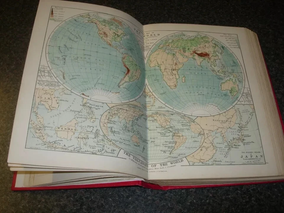


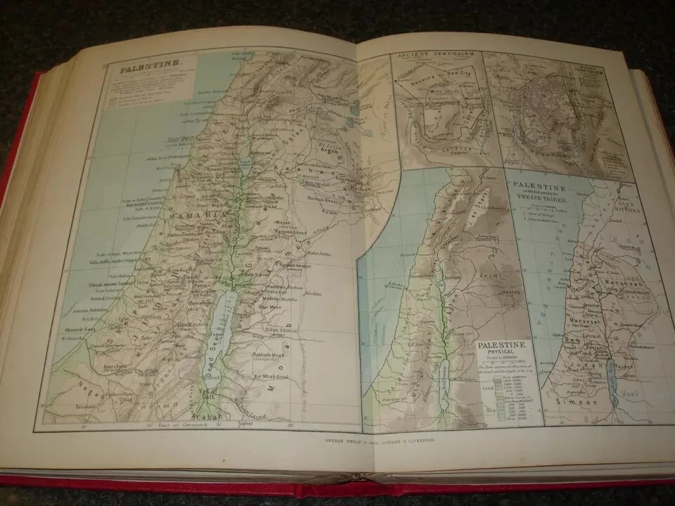
Traditional cartography in the early 19th century tended to prioritise geographic discovery and documentation - the laborious mapping of coasts, rivers, and inland regions as they were encountered by travellers. By contrast, Ravenstein’s Systematic Atlas sought to organise what was already known into a format conducive to structured learning and comparative analysis.
Ravenstein’s own preface clarifies the intention behind this structure.
He distinguished the atlas from what he termed “miscellaneous collections of maps,” emphasising that the plates were arranged according to a deliberate plan. Physical geography forms the foundation; political and commercial divisions follow. Scale choices were made to preserve comparability between regions, even where that required omission.
Several aspects of his atlas reflect this:
Indexed Place-Name Access: An alphabetical listing of approximately 12,000 place names allowed readers to locate specific points across plates efficiently without sequential reading.
Consistent Plate Structure: Each plate adheres to a standardised cartographic convention (symbols, scale, layout), enabling direct comparison from region to region.
Physical + Political Juxtaposition: By pairing terrain features with political boundaries across the same plate set, readers could engage with multiple dimensions of geography at once - a pedagogical shift away from narrative exposition toward integrated visual analysis.
Built for instruction, it uses consistent scales and an extensive index so students could retrieve and compare places quickly. That pragmatic design reflects Ravenstein’s large-scale mapping work for the Royal Geographical Society, where compilation and revision were routine practice.
Imperial Context and Cartographic Revision
Late nineteenth-century African cartography drew upon multiple sources: explorer journals, survey measurements, missionary accounts, and colonial administrative reports. Ravenstein’s contribution was to assemble these materials into a coherent framework and to revise that framework as additional information emerged. River courses were adjusted, interior boundaries refined, and spatial relationships clarified as new data accumulated.
This work unfolded during a period of accelerating imperial competition. The Berlin Conference of 1884–1885, convened in Germany to regulate European territorial claims in Africa, established the principle of “effective occupation.” European powers were expected to demonstrate administrative control rather than merely assert symbolic possession. The conference did not partition Africa in a single act, but it formalised procedures that intensified territorial demarcation.
Cartography became central to this process. Boundaries required clearer definition; river systems and internal divisions had to be documented with increasing precision. Maps were more than exploratory sketches - they were administrative instruments.
The same discipline informs the Systematic Atlas. In his preface, Ravenstein distinguished the work from “miscellaneous collections of maps,” emphasising that the plates were arranged according to a deliberate plan. Physical geography formed the foundation; political and commercial divisions followed. Scale was selected to preserve comparability, even where omission was necessary to maintain coherence.
He also noted that particular attention had been given to regions of direct interest to British students. The atlas was conceived as a structured instrument for a specific educational environment.
By the 1890s, mapping operated simultaneously within educational and imperial frameworks. Cartographic clarity supported territorial demarcation and governance, while classroom atlases trained readers to recognise political overlays and physical constraints within a global system.
Ravenstein and the Victoria Medal (1902): A Closer Look
In 1902, Ravenstein became the first recipient of the Royal Geographical Society’s Victoria Medal, established to honour “conspicuous merit in research in geography.” The award is rooted in the Society’s long tradition of distinguishing significant contributions to geographic science and exploration.
The RGS instituted the Victoria Medal as a separate honour for research achievement, echoing the design and prestige of earlier medal awards but with a distinct focus on scientific contribution rather than exploratory travel. According to specialist cartographic historians, the Society’s decision acknowledged Ravenstein’s “efforts during 40 years to introduce scientific methods into the cartography of the United Kingdom.” His work emphasised systematic representation, rigorous compilation, and statistical integration - facets that distinguished him from earlier mapmakers.
Ravenstein’s receipt of the medal alongside later recipients such as Sven Hedin (1903) and John George Bartholomew (1905) places him in a lineage of notable geographers recognised for advancing the discipline’s technical and analytical foundations.
That the first Victoria Medal was awarded to a figure noted more for analytical synthesis than for travel reflects a subtle shift in the discipline toward valuing research rigour and methodological innovation. The medal acknowledged not just the production of maps, but a broader cultivation of geographic science rooted in structured data, measurement, and representation.
Earlier honours often celebrated expeditionary achievement whereas the Victoria Medal marked a shift toward recognising sustained methodological contribution.
Conclusion
Ernst Georg Ravenstein’s Philip’s Systematic Atlas exemplifies the late Victorian consolidation of geography as a disciplined field.
This approach aligns with what later academic geographers would formalise as spatial analysis: the systematic study of geographic phenomena in relation to one another across space and scale.
While Ravenstein was not theorising in the abstract terms of 20th-century academic geography, his insistence on structure and comparability foreshadows that disciplinary emphasis.
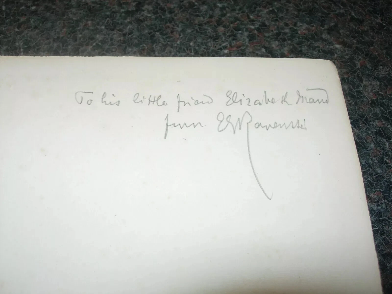
The 1894 inscribed copy evidenced here showcases material evidence of a moment when cartography, education, and administrative knowledge converged in a coherent institutional framework.
If you'd like more information on the signed 1894 edition you can browse the listing here
To explore further items in my stock click the button below


Comments